1. Why alignment matters
A good SDS320 project does not simply combine an interesting dataset with an impressive method. The research question, available data and analytical method need to fit together.
A project can fail even when each part sounds good individually. A strong GeoAI method will not help if the data do not contain the target feature. A detailed dataset will not help if the question is too broad. A good question will not work if the data cannot be accessed, processed or evaluated in time.
2. The alignment triangle
Think of your project as a triangle:
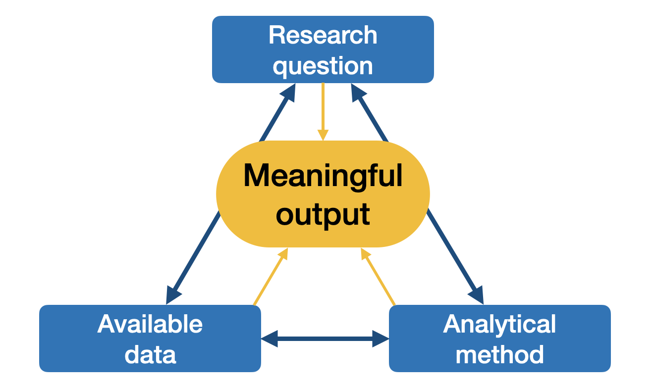
The alignment triangle: Research question ↔ Available data ↔ Analytical method. Each side needs to support the others.
A coherent project can complete this sentence:
My project asks [question], uses [data], applies [method], and produces [output].3. Choosing suitable data
When choosing data, check the following criteria.
| Criterion | Questions to ask |
|---|---|
| Spatial resolution | Are the relevant features visible at this scale? |
| Temporal coverage | Does the dataset cover the relevant dates or seasons? |
| Study area | Does the dataset cover the full Area of Interest (AOI)? |
| Format | Can you open, process and document it? |
| Licence | Are you allowed to use and share the data or derived outputs? |
| Accessibility | Can you access the data reliably? |
| Size | Can you process it with your available time and hardware? |
| Quality | Are there clouds, gaps, noise, missing values or uncertain labels? |
| Documentation | Are metadata, methods and limitations described clearly? |
For GeoAI projects, data suitability depends on the task. Object detection needs objects that are visible and separable. Segmentation needs labels or masks if you train or evaluate a model. Change detection needs comparable observations across time.
4. Choosing suitable methods
Choose methods based on the question and data.
Use this logic:
| Project need | Possible method direction |
|---|---|
| Classify full images or scenes | Image recognition or classification |
| Locate discrete objects | Object detection |
| Assign a class to every pixel | Semantic segmentation |
| Separate individual objects | Instance segmentation |
| Compare places or times | Change detection or spatial comparison |
| Predict continuous values | Regression |
| Explore similarity or representation space | Satellite embeddings |
| Use a broad pre-trained model | Foundation model or prompt-based workflow |
This table is a starting point, not a rule. The final method choice should be justified in your report and presentation.
5. Managing scope
Scope is the size and complexity of your project. Managing scope does not mean making the project weak. It means making it possible to finish well.
Ways to reduce scope include:
smaller study area,
shorter time period,
fewer classes,
fewer input datasets,
fewer model comparisons,
one clear output,
lower spatial resolution,
one representative case study,
simpler baseline method,
less automation for optional steps.
For a semester project, depth is usually better than width. A focused project with a clear output, evaluation and limitation discussion is stronger than a broad project that remains unfinished.
6. Data-method fit examples
These examples are illustrative.
| Question type | Data need | Method fit |
|---|---|---|
| Where are individual trees visible in a neighbourhood? | High-resolution imagery and object annotations or validation data | Object detection or instance segmentation |
| How did land cover change between two dates? | Comparable imagery from both dates | Change detection or classification comparison |
| Can imagery separate water, vegetation and built-up areas? | Multispectral imagery and reference labels or plausibility checks | Semantic segmentation or classification |
| Where are prediction errors largest? | Model output and reference data | Error map, residual analysis or uncertainty discussion |
| Which image areas look similar? | Image chips or embeddings | Satellite embeddings and clustering or similarity search |
7. Flags & checks
| Red flag | First check |
|---|---|
| The question does not mention where or when | Add study area and time period. |
| The method was chosen before the question was clear | Return to Research question. |
| The data are interesting but do not answer the question | Revise the question or find better data. |
| The target feature is not visible in the imagery | Use different data, reduce expectations or change the task. |
| The project needs labels but none are available | Create a small labelled dataset, use a pre-trained model or reduce scope. |
| The dataset is too large to process | Reduce area, time period, resolution or number of files. |
| There is no evaluation strategy | Identify reference data, visual checks or a meaningful comparison. |
| The project has many outputs but no main result | Choose one key output and build the workflow around it. |
8. Mini task
Write one alignment statement for your project:
My project asks ...
It uses ...
It applies ...
It produces ...
It will be evaluated by ...
The main limitation is likely ...
Then check whether every part fits together. If one part feels weak, revise it before adding more complexity.
9. Key takeaways
Question, data and method need to fit together.
Interesting data and impressive methods are not enough on their own.
Scope reduction is a normal project skill.
A focused project is easier to implement, evaluate and communicate.
Choose methods because they answer the question, not because they sound advanced.